


Maps, Parking & Coming By Boat
Find the show, download maps, review parking options, and plan an arrival by land or by sea.
Directions - By Land
From points east-northeast: Coastal Route 1 is the best bet. The show is located on the southern side of Rockland.
From points northwest: Route 17 comes directly into the northern side of Rockland; turn right onto Route 1 southbound to get to the show.
From the south: Stay on Route 1 through Thomaston to Rockland. Take a right at the Main Street light. The main show entrance is on the left, or go straight at the light to the Buoy Park entrance.
Directions - By Sea
Use NOAA chart 13302, "Penobscot Bay and Approaches," or Maptech Waterproof Chart #40, "Rockland to Mount Desert Island."
Rockland Harbormaster: 207-594-0312 | VHF Channel 16
www.rocklandharbor.info
The Harbormaster operates the Public Landing and can help with mooring information in Rockland Harbor.
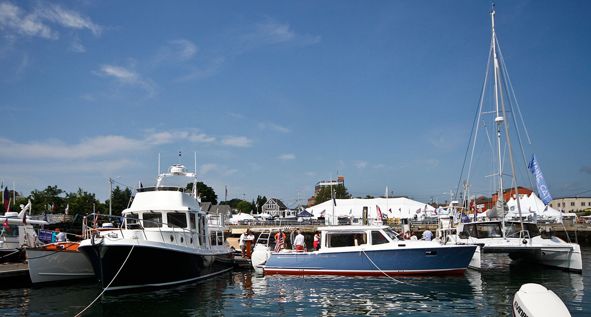
Harbor Park and the Rockland waterfront are at the center of the Maine Boat & Home Show.
Maps
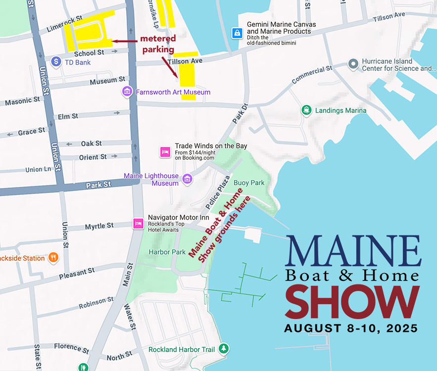
Google Directions
Directions to Harbor Park and the Rockland waterfront show entrance.
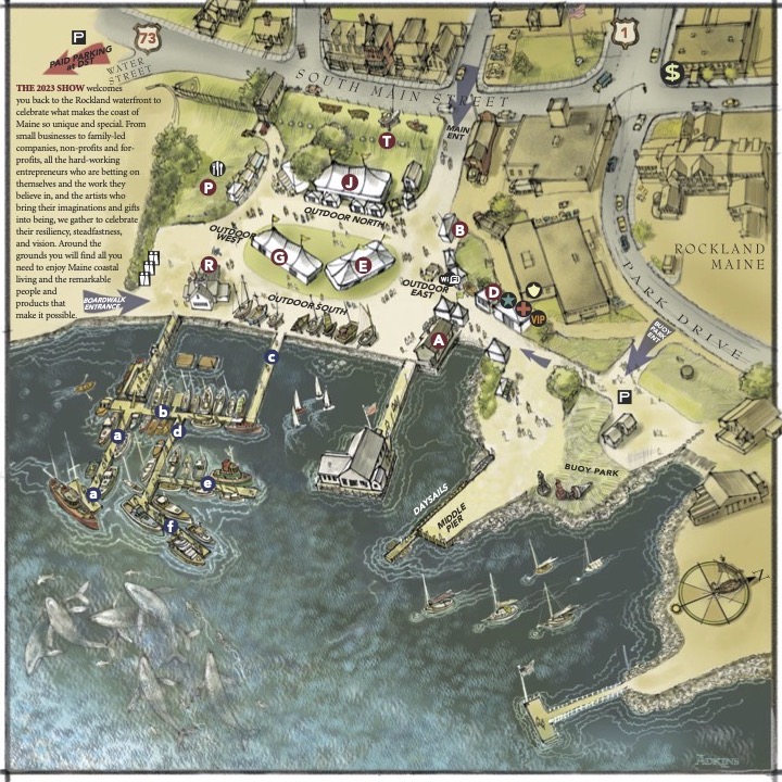
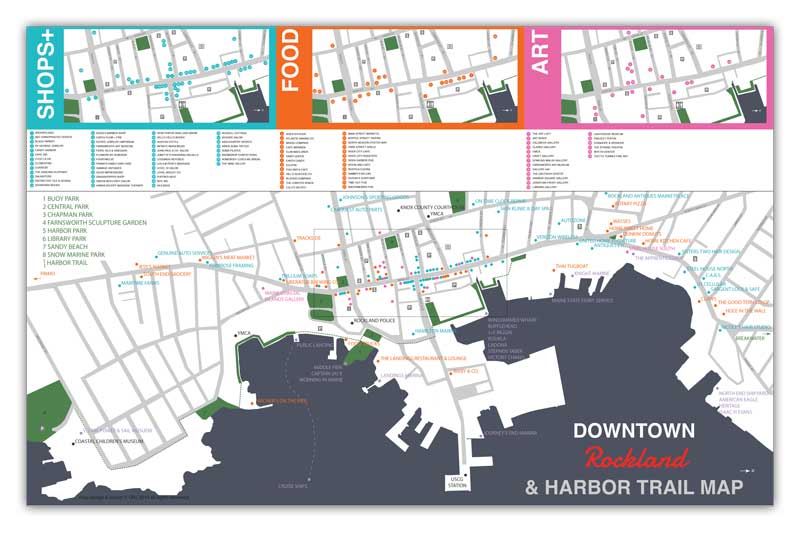
Parking
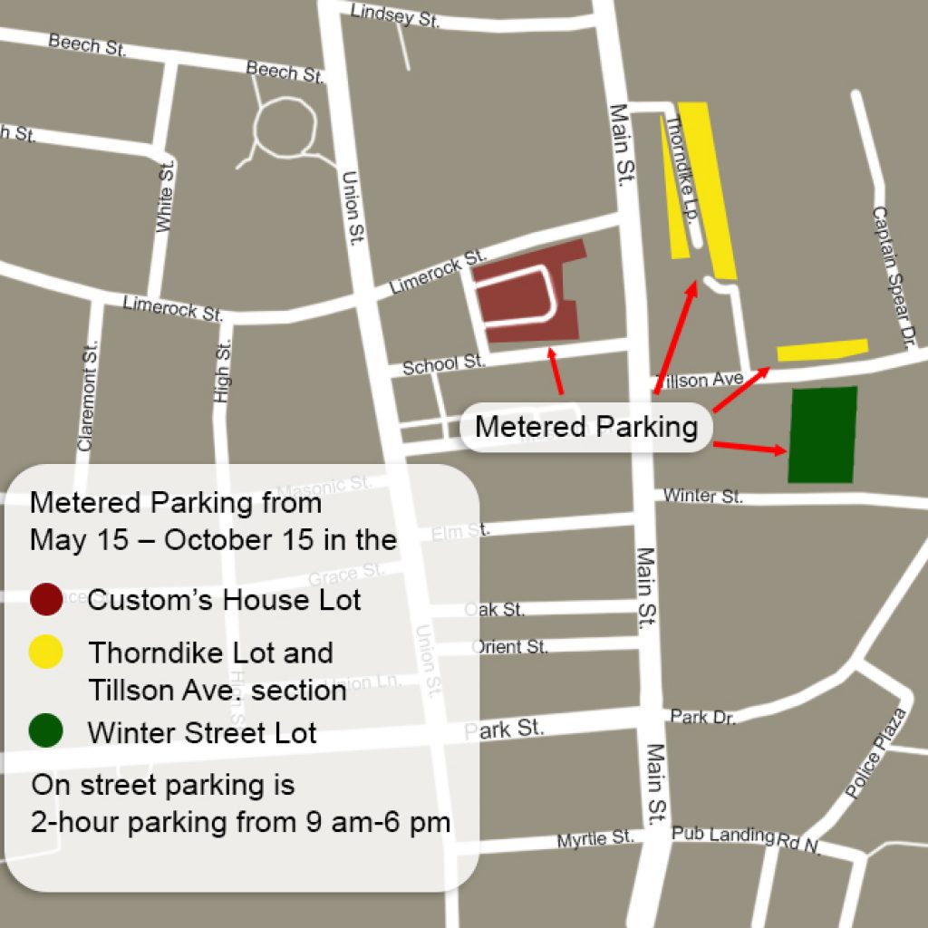
There is limited all-day parking in Rockland. Please consult the Rockland map for areas that do not have time limits.
Handicapped parking is available on Myrtle Street next to Walgreens, but not in the Walgreens lot.
Paid parking, $10/day from 8:00 a.m. until closing, is available at the private lot on Water Street right next to the show grounds. Proceeds benefit local nonprofits.
Local Services for Boaters
Welcome to Rockland! Rockland is a full-service destination for boaters with a long maritime history, a working waterfront, a thriving schooner fleet, and convenient services for recreational craft of all sizes.
Services abound for boaters: More than 100 rental moorings, dockage for vessels up to 250 feet, pumpout services, full-service boatyards, parts and marine supplies, fuel, ice, and laundry.
Within easy walking distance of the harbor: Provisions, groceries, fresh seafood, drugstore, restaurants and pubs, movie theater, live events, museums, galleries, shopping, pet supplies, day spas, library, post office, banking, and ATMs.
Rockland Harbormaster
207-594-0312 | VHF Channel 16
www.rocklandharbor.info
Official address: 1 Harbor Park, Rockland, ME 04841
Mailing address: 270 Pleasant Street, Rockland, ME 04841
Launch Services
- Rockland Yacht Club Launch: 8 a.m.-8 p.m. / VHF Channel 9 / 207-233-2800
- Two Toots: VHF Channel 9 / 207-594-2891
Boat Supplies
Hamilton Marine: 20 Park Drive, Rockland, ME 04841 / 207-594-8181 / www.hamiltonmarine.com
Summer Hours (April - August): Monday-Friday, 7 a.m.-6 p.m. / Saturday, 8 a.m.-5 p.m. / Sunday 9 a.m.-4 p.m. Winter Hours (September - March): Monday-Friday, 7 a.m.-5 p.m. / Saturday, 8 a.m.-5 p.m. / Closed Sunday.
Rockland Boatyards & Marinas
- Johanson Boatworks: 11 Farwell Drive / 207-596-7060 / www.jboatworks.com
- Journey's End Marina: 120 Tillson Avenue / 207-594-4444 / VHF Ch. 09, 18 / www.journeysendmarina.com
- Knight Marine: 525 Main Street / 207-594-4068 / www.knightmarineservice.com
- Ocean Pursuits Marine Services: 75 Front Street / 207-596-7357 / www.oceanpursuits.com
- Rockland Landings Marina: 5 Commercial Street / 207-594-4899 / www.rocklandlandingsmarina.com
- Rockland Public Landing: 270 Pleasant Street / Harbormaster: 207-594-0312 / www.rocklandharbor.info
- Safe Harbor | Trident Yacht Basin: 60 Ocean Street / 207-236-8100 / Safe Harbor Rockland
Navigation, Hazards & Emergency Services
Navigation and hazards: Charts: NOAA chart 13302, "Penobscot Bay and Approaches," or Maptech Waterproof Chart #40, "Rockland to Mount Desert Island." Rockland sits on the west shore of West Penobscot Bay between Owls Head and Jameson Point. The breakwater extends from Jameson Point, with Rockland Breakwater Light at the end of the breakwater. Enter the harbor southward of the breakwater light, giving it a berth of 100 yards or more. The approach channel has three branch channels, all buoyed.
Hazards: Several rocks, ledges, shoal areas, and dangerous wrecks are in the harbor. Use the chart as a guide and give hazards appropriate clearance. Tides: the mean range of tide is 9.7 feet.
- Airport: Knox County Regional, Owls Head / 207-596-0617
- Coast Guard: Rockland / 207-596-6667 or VHF 16
- Harbormaster: Rockland / 207-594-0312
- Police, Fire, Ambulance: 911