
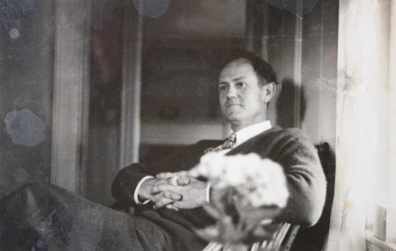
 Augustus “Gus” Phillips, 1898-1975. Photo courtesy of Phillips family
To look at a Phillips Brothers’ map of Maine is to receive an invitation from cartographers Luther and Gus Phillips to explore more than the quickest route to one’s destination. Between the early 1930s and the mid 1970s, their depictions of the state were as much works of art as wayfinding tools.
The men got their start as creators and purveyors of pictorial maps and photographic postcards. Later, Gus, the younger of the two, introduced recreational and painted maps to his cartographic output.
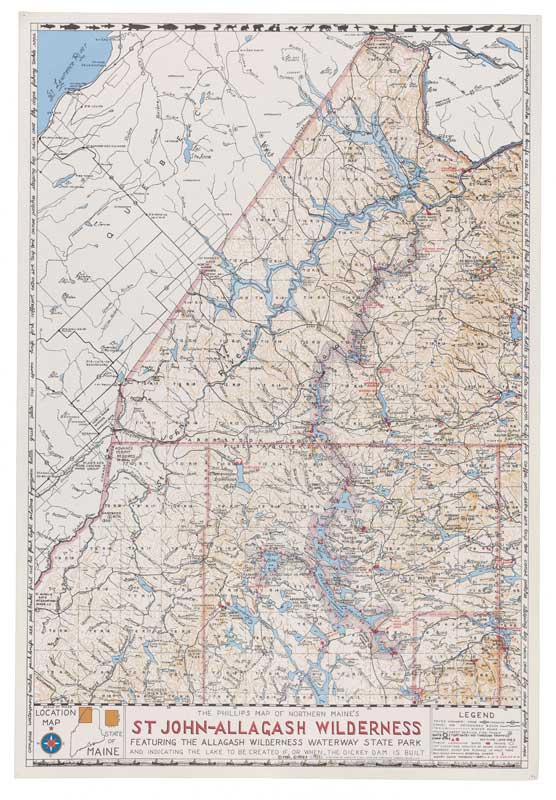 Phillips’ Map of Northern Maine’s St. John-Allagash Wilderness. Map image courtesy of the Penobscot Marine MuseumBoth their love for traveling in Maine’s wilderness regions and for supporting themselves as visual artists were integral to the establishment of The Phillips Maps of Maine and State O’ Maine Post Cards businesses.
Luther—who founded the companies—soon took on his brother as an apprentice. Initially, Luther drafted the maps, and Gus added the color.
Ben Meader, a cartographer well acquainted with the Phillips Brothers’ work, described their workflow as more than just cartography—they were also their own distributors. “The Phillips brothers traced, inked, painted, and lettered their maps from scratch. The maps were published and distributed by the authors themselves—often covering hundreds of miles across Maine—and sold directly from the back of a station wagon.” Delivery trips often included research into new roads, lodging, and tourist sites, resulting in revised editions, he noted.
By the 1940s, Phillips maps and postcards of interior Maine were appearing in many of the sporting camps throughout the North Maine Woods—maps were used as camp decoration, and the postcards were sold to the lodgers. There were maps of the Allagash and the St. John rivers, the Rangeley Lakes Region, the Moosehead Lake Region, Baxter State Park, the Grand Lake Stream area, and Sebago Lake.
 Augustus “Gus” Phillips, 1898-1975. Photo courtesy of Phillips familyIn their travels, friendships developed between many of the business owners and the brothers as they delivered orders year after year. While Luther’s approach to his clientele was businesslike, Gus would often linger to chat, frequently over a cup of coffee and a piece of apple pie. His delivery routes frequently included overnight stays, often at Augustine’s in Shin Pond or at Pray’s at Ripogenus Dam, on the west branch of the Penobscot River, places where he developed lifelong friendships.
When he could afford a flight, Gus flew with one of the several bush pilots he had befriended, photographing aerial postcards of the lakes and waterways of the North Maine Woods. Although Luther and Gus shared some similar artistic and business goals, they clearly took different paths in life.
Luther Savage Phillips, as a teenager, worked summers at the Asticou Inn at the head of Northeast Harbor. Sometimes wealthy visitors sponsored local youths, providing educational opportunities off-island. Luther’s father, an educator and truck farmer, gave his permission when Luther was offered just such a sponsorship to attend Phillips Andover Academy in Andover, Massachusetts. The summer after graduation he toured Europe with his sponsor and then matriculated at Yale. After two years at Yale, Luther transferred to the Massachusetts Institute of Technology, and in 1914 graduated from the Department of Architecture. He joined the Navy and attended the US Naval Academy in Annapolis, Maryland. His naval travels took him to many foreign ports; while in Turkey, he met his future wife.
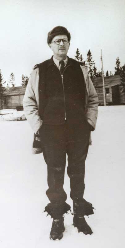
While Luther graduated from MIT, Gus completed his formal education in Maine, entering Hebron Academy for his junior and senior years of high school. There, Gus played several sports and relished his English classes, excelling at recitation and memorizing poems. After graduating in 1919, Gus briefly attended the University of Maine, but by October, he was working as a Maine Guide.
 Mount Kineo on Moosehead Lake is pictured in this Luther Phillips postcard. Photo of postcard courtesy of John T. Meader
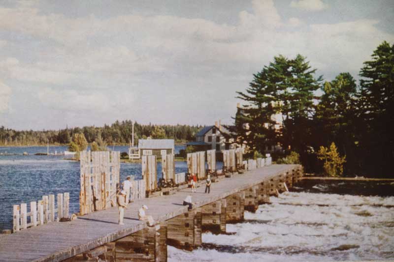 The dam at East Outlet with Wilsons on Moosehead Lake in the background. Postcard by Luther Phillips. Photo of postcard courtesy of John T. MeaderGuiding “sports”, as the guests were called, in the Maine woods led him to buy land and a small house in Greenfield. He then married his high school sweetheart, Mary Craig, who had been a neighbor’s governess back in Northeast Harbor. By the late 1930s, Gus and Mary had five children and had moved back to Northeast Harbor. A series of seasonal jobs—including cutting and sluicing ice, delivering produce from the family garden, and chopping and delivering cords of wood—supplemented his map and postcard income.
The map and postcard business required many hours of dedication on top of his other jobs. Still, Gus deliberately carved out time to paint island views during the late 1930s. His plein air painting later would inspire him to do painted maps as well.
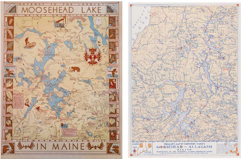 (Left): Luther’s 1953 pictorial map of Moosehead Lake, colored and updated by Gus in 1971. (Right): Gus’s 1965 recreational map of the Moosehead-Allagash Region. Maps courtesy Penobscot Marine Museum
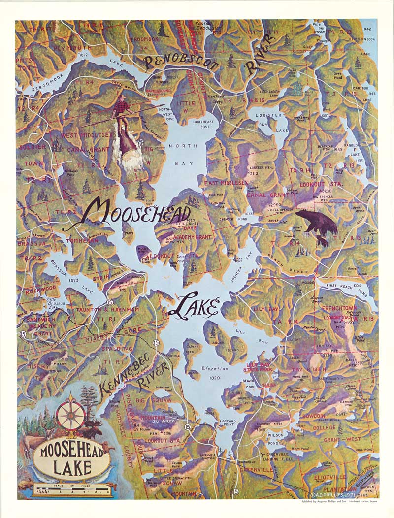 Painted map of Moosehead Lake by Gus Phillips, 1971. Map courtesy Penobscot Marine MuseumSometimes he brought his youngest daughter, Mary Jane, with him. Many years later it was she who donated Luther’s and Gus’s maps and postcards to the Penobscot Marine Museum in Searsport, Maine. The Phillips brothers created dozens of maps and hundreds of postcards. There were maps of both coastal and inland areas. The locations that intrigued the Phillips brothers often received multiple treatments. Along the coast, it was numerous maps of Mount Desert Island, while inland we find four different maps of Moosehead Lake.
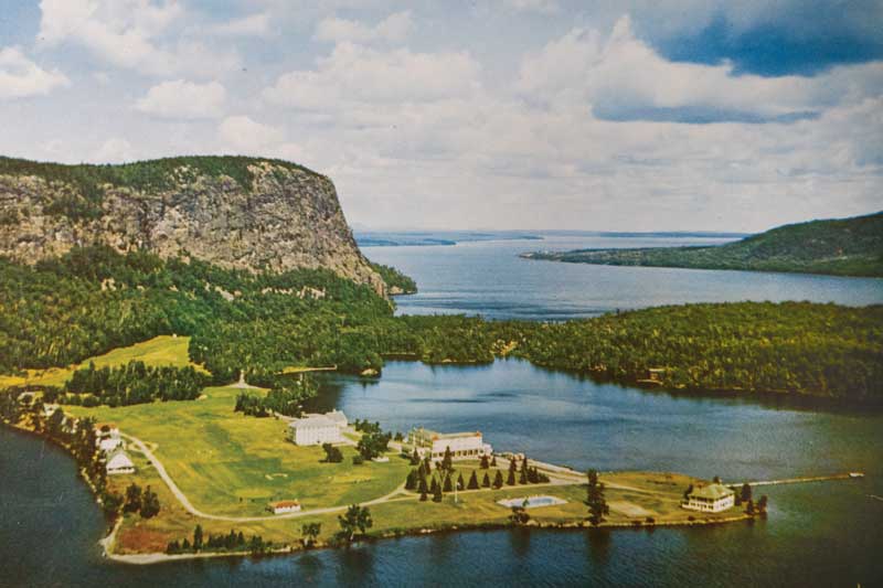
The brothers were drawn to this part of Maine frequently, as they boated, walked, and flew over the landscape. Their earliest Moosehead map is Luther’s 1953 pictorial map. The edge of the map is framed by the hand lettered statement GATEWAY TO HAPPINESS and illustrations of local tree specimens. Luther identifies many local businesses, some on a scroll such as Sanders Store, The Indian Store, and Folsom’s Flying Service. Numerous sporting camps are identified on waterways.
Ten years later, Gus’s life had changed. Luther passed away on Christmas eve in 1960, leaving Gus the sole proprietor of the map and postcard companies. His first order of business was to fill current orders and republish older maps and postcards. Eventually he found the time to create more of his own work. In 1963 he published his recreational map titled “Phillips’ Map of Northern Maine’s Moosehead-Allagash Region.” Creating a recreational map is different from a pictorial map. Here Gus focused on the specific features vacationers would seek, including paved and gravel roads, trails, public boat launches, and wilderness campsites.
The third map is Gus’s painted map, titled simply “Moosehead Lake.” By painting light and shadows to depict the rugged terrain surrounding the lake, Gus illustrated the three-dimensionality of the region. By combining the use of 3D terrain with the imagery of loggers and animals, Gus used elements of both pictorial and recreational maps, creating his own cartographic style. He chose to remind us of the flora and fauna in the region by embellishing the cartouche with painted evergreens, fish, and local animals.
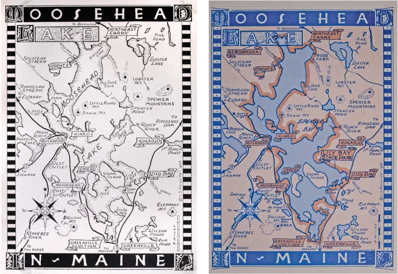 Phillips postcard maps of Moosehead Lake: Luther’s 1953 original and Gus’s 1963 version. Photos of map postcards courtesy of John T. MeaderAmong the hundreds of postcards that the brothers created, only a couple dozen or so were “map postcards.” Among them was the popular Moosehead Lake card, their fourth unique map of Maine’s largest lake. Originally drawn and printed in black and white, later editions were colored.
On several Phillips maps, Gus and Luther share quotes by their favorite writers—frequently Shakespeare or Thoreau—as well as wordsmithing of their own. Indeed, captivating their audience is a skill common to the brothers’ artistry. It is demonstrated by Gus in the early 1960s—this time in wood rather than on paper—when he carved 48 small panels, which depict local flora and fauna, for the gates that welcome visitors to Thuya Garden in Northeast Harbor.
On Gus’s 1971 Phillips Map of Northern Maine’s St. John-Allagash Wilderness, he included a cursive list of useful items to take on a fishing trip—fly dope, extra socks, canoe patches, and waterproof matches—all relatable to those with their own camping memories, and good advice to beginners. Gus continued making maps and shooting postcards until close to his death in 1975.
The Phillips artistry invites one to interact with the brothers’ work, and by extension, excites curiosity about the artists themselves. Thanks to the Penobscot Marine Museum’s preservation and the interest of new generations who are discovering the Phillips brothers’ artistry, Gus’s and Luther’s invitation to explore Maine continues. These men, ordinary Mainers with extraordinary talent, put Maine attractions on the map.
✮
Catherine Phillips Jewitt is a Presque Isle, Maine, native and a retired teacher who taught in both boarding and public schools for 39 years. John Turner Meader of Fairfield, Maine, is a photographer and an astronomy educator. He has travelled to Maine schools and libraries for 38 years with his business Northern Stars Planetarium.
Gus Phillips’s Maine, Then and Now
What happens when a cartographer, a photographer, and a writer walk into a museum?
Eight years ago, the Phillips Collection of postcards, slides, and maps was given to the Penobscot Marine Museum in Searsport by Gus’s daughter, Mary Jane “MJ” Phillips Smith. Soon, cartographer Ben Meader, his father, photographer John Meader, and I, a retired English teacher, met at the Penobscot Marine Museum to help sort and organize the postcards in the Phillips Collection.
My grandfather, Gus Phillips, placed each postcard into its own sealed and labeled envelope, often with its original slide or negative. As we unsealed those envelopes and recorded their contents, we were impressed by the variety of subjects and locations throughout Maine that Gus photographed as proprietor of State O’ Maine Post Cards. As Mainers who had visited many of the locations in the postcards, we frequently stopped to ask “Do you remember…” We compared various postcard views to our own experiences, sparking conversations about whether the locations in Gus’s images from the 1960s are still the same, different, or totally gone today.
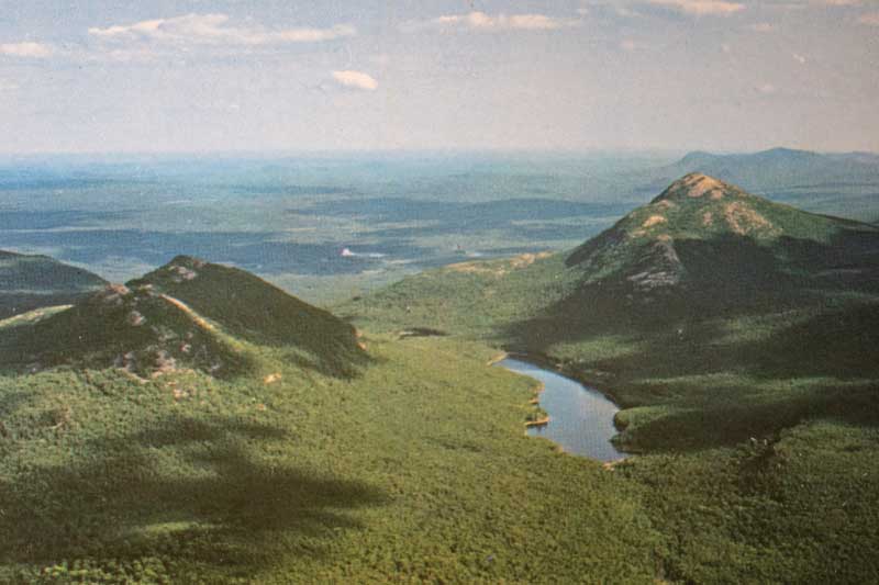
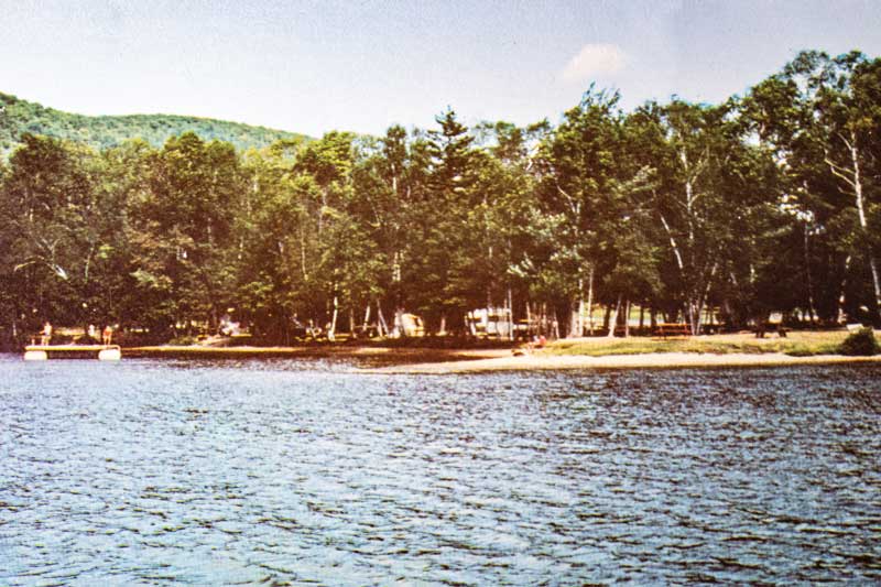
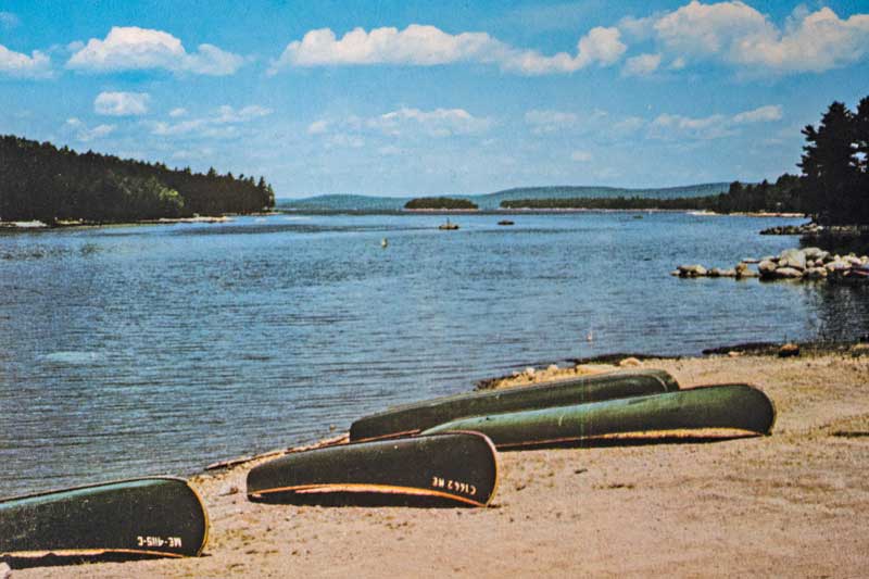
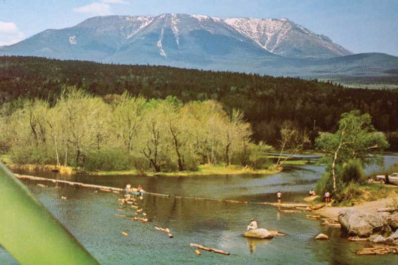 From top to bottom: Postcards of Maine’s inland lakes and waterways by Gus Phillips include Birch Point Camping Area at Pleasant Lake, Island Falls; Study Canoes on the shore of West Grand Lake; Middle Fowler Pond in Baxter State Park; and Mount Katahdin from Abol Bridge on the Penobscot River. Photos of postcards courtesy of John T. Meader (4)
Over lunch at Anglers Restaurant in Searsport, we discussed how to share Gus’s creativity, explorations, and travels throughout Maine. As a result of this conversation, we created the blog “Postcards from Gus: A Modern Travelogue Through Maine’s Past.”
We invite you to join us as we revisit Gus’s Maine, comparing what he saw to what we find today. You can find our blog entries at sandboxatlas.org/postcards-from-gus.
—Cathy Phillips Jewitt